![[ACROSS THE SPINWARD MAIN]](title-small.png)
Astrography
On this page:
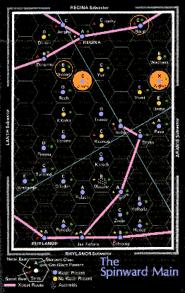
Campaign Map
The campaign takes place along the Spinward Marches known as the Spinward Main, a contiguous Jump-1 trade route which visits more than 50% of the systems in the sector.
The view covers part of the four sub-sectors of Regina, Aramis, Lanth and Rhylanor and is skewed to fit the areas of interest into a single sub-sector grid. The majority of the campaign takes place in this region.
Click the map or here for a larger version (850kB). The larger version includes UWPs for the systems displayed.
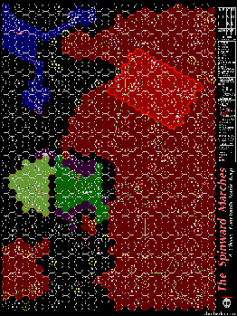
The Spinward Marches
The Spinward Marches is the local administrative area. The map is colour coded to represent political allegiances.
- Imperial territories are dark red
- Zhodani territories are blue
- The Sword Worlds are green
- Darrian Confederacy is dark yellow
The bright red area represents the region of the campaign map above.
Click here or on the map for a larger view.
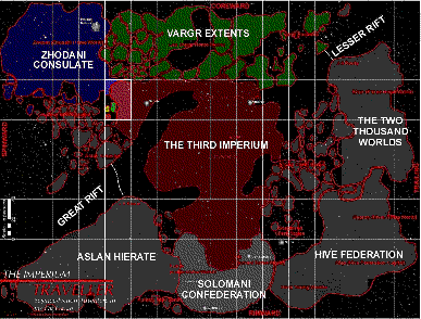
The Imperium
This map shows the region colloquially called Known Space. More has been explored, in particular with the Core Expeditions and the Rim Expedition, but almost all the inhabited world fall within this region.
The highlighted area shows the Spinward Marches.
Click here or on the map for a larger view.
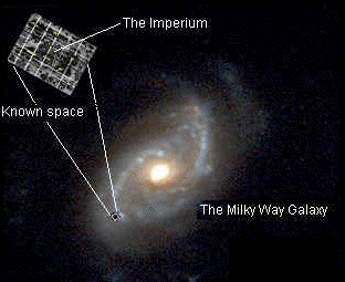
The Milky Way Galaxy
For the final piece of perspective, here is a comparison of known space with the rest of our galaxy. There's no larger view.